Geolocate

Saletta topographic map

Click on the map to display elevation.

About this map

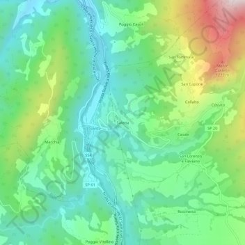
Name: Saletta topographic map, elevation, terrain.

Location: Saletta, Amatrice, Rieti, Lazio, 02011, Italia (42.65132 13.25206 42.69132 13.29206)

Average elevation: 3,045 ft

Minimum elevation: 2,408 ft

Maximum elevation: 4,505 ft

Gear up for your next adventure:

🔪Outdoor Multitools - Essential survival tools for gear repair and field use
🌐World Map Poster - Decorative world maps with topographic info
🌎3D Topographic Globes - Raised relief globes for a tactile understanding of geography
🧦Hiking Socks - Comfortable socks to prevent blisters on long hikes
🖼️Topo Map Wall Art - Decorative topographic prints of famous peaks and regions

As an Amazon Associate, this site earns from qualifying purchases at no extra cost to you.