
Thank you for supporting this site ❤️
Make a donation
Make a donation
Gear up for your next adventure:
As an Amazon Associate, this site earns from qualifying purchases at no extra cost to you.
温台 topographic map
Click on the map to display elevation.
Thank you for supporting this site ❤️
Make a donation
Make a donation
Gear up for your next adventure:
As an Amazon Associate, this site earns from qualifying purchases at no extra cost to you.
About this map
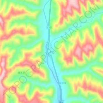
Name: 温台 topographic map, elevation, terrain.
Location: 温台, 华池县, 庆阳市, 甘肃省, 中国 (36.34386 107.88866 36.38386 107.92866)
Average elevation: 4,268 ft
Minimum elevation: 3,848 ft
Maximum elevation: 4,767 ft
Thank you for supporting this site ❤️
Make a donation
Make a donation
Gear up for your next adventure:
As an Amazon Associate, this site earns from qualifying purchases at no extra cost to you.