
Goose Corner topographic map
Click on the map to display elevation.
About this map
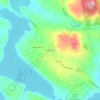
Name: Goose Corner topographic map, elevation, terrain.
Average elevation: 620 ft
Minimum elevation: 489 ft
Maximum elevation: 938 ft
Carroll County trails, hiking, mountain biking, running and outdoor activities
Other topographic maps
Click on a map to view its topography, its elevation and its terrain.
Bill Rae Conservation Area
United States > New Hampshire > Carroll County > Wolfeboro > Stockbridge Corner
Average elevation: 801 ft