
Thank you for supporting this site ❤️
Make a donation
Make a donation
Gear up for your next adventure:
As an Amazon Associate, this site earns from qualifying purchases at no extra cost to you.
Seefeld in Tirol topographic map
Click on the map to display elevation.
Thank you for supporting this site ❤️
Make a donation
Make a donation
Gear up for your next adventure:
As an Amazon Associate, this site earns from qualifying purchases at no extra cost to you.
About this map
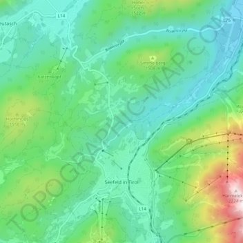
Name: Seefeld in Tirol topographic map, elevation, terrain.
Location: Seefeld in Tirol, Bezirk Innsbruck-Land, 6100, Austria (47.31939 11.16352 47.37000 11.25692)
Average elevation: 4,275 ft
Minimum elevation: 3,294 ft
Maximum elevation: 7,336 ft
Thank you for supporting this site ❤️
Make a donation
Make a donation
Gear up for your next adventure:
As an Amazon Associate, this site earns from qualifying purchases at no extra cost to you.