
Thank you for supporting this site ❤️
Make a donation
Make a donation
Gear up for your next adventure:
As an Amazon Associate, this site earns from qualifying purchases at no extra cost to you.
Kolbermoor topographic map
Click on the map to display elevation.
Thank you for supporting this site ❤️
Make a donation
Make a donation
Gear up for your next adventure:
As an Amazon Associate, this site earns from qualifying purchases at no extra cost to you.
About this map
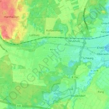
Name: Kolbermoor topographic map, elevation, terrain.
Location: Kolbermoor, Landkreis Rosenheim, Bavaria, 83059, Germany (47.81625 12.00213 47.87050 12.08417)
Average elevation: 1,532 ft
Minimum elevation: 1,463 ft
Maximum elevation: 1,654 ft
Thank you for supporting this site ❤️
Make a donation
Make a donation
Gear up for your next adventure:
As an Amazon Associate, this site earns from qualifying purchases at no extra cost to you.