Geolocate

Gion topographic map

Click on the map to display elevation.

About this map

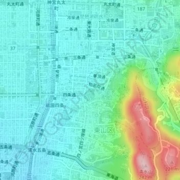
Name: Gion topographic map, elevation, terrain.

Location: Gion, Higashiyama Ward, Kyoto, Kyoto Prefecture, Japan (35.00085 135.77152 35.00806 135.78555)

Average elevation: 249 ft

Minimum elevation: 102 ft

Maximum elevation: 771 ft

Other topographic maps

Click on a map to view its topography, its elevation and its terrain.

Katsura Imperial Villa

Japan > Kyoto

Average elevation: 82 ft

Gear up for your next adventure:

🧤Hiking Gloves - Protective gloves for rugged trails
🔭Telescopic Hiking Pole - Adjustable pole for hiking stability
🛌Ultralight Sleeping Bags - Compact down bags for cold nights in the wilderness
🧯Portable Fire Pit - Compact fire pit for camping spots
🧭GPS Watch Accessories - Bands and chargers for GPS watches

As an Amazon Associate, this site earns from qualifying purchases at no extra cost to you.