Geolocate

Mayberry topographic map

Click on the map to display elevation.

About this map

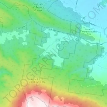
Name: Mayberry topographic map, elevation, terrain.

Location: Mayberry, Meander Valley, Tasmania, Australia (-41.61349 146.23257 -41.52922 146.33471)

Average elevation: 1,768 ft

Minimum elevation: 669 ft

Maximum elevation: 4,633 ft

Other topographic maps

Click on a map to view its topography, its elevation and its terrain.

Cathedral Mountain

Australia > Tasmania

Average elevation: 3,255 ft

Waterworks Reserve

Australia > Tasmania > Hobart

Average elevation: 787 ft

Rowlands Hill

Australia > Tasmania

Average elevation: 1,273 ft

Cradle Mountain

Australia > Tasmania > Cradle Mountain

Average elevation: 3,753 ft

The Nut

Australia > Tasmania > Stanley

Average elevation: 26 ft

Bream Creek

Australia > Tasmania > Bream Creek

Average elevation: 115 ft

Buxton Point

Australia > Tasmania > Little Swanport

Average elevation: 10 ft

Mount Patrick

Australia > Tasmania

Average elevation: 2,831 ft

Mount Ossa

Australia > Tasmania

Average elevation: 3,996 ft

West Gawler River

Australia > Tasmania > Sprent > Gawler

Average elevation: 659 ft

Mount Tyndall

Australia > Tasmania

Average elevation: 2,986 ft

Gear up for your next adventure:

🧣Merino Neck Gaiters - Multi-functional headwear for wind and sun protection
⛑️Personal Locator Beacon - Safety beacon for emergencies
🔭Stargazing Telescopes - Perfect for camping in low-light pollution areas shown on maps
🥇GPS Hiking Watch - Multi‑sport GPS watch with navigation and trail tracking
🛡️Bear Spray Outdoor - Protection in bear country hikes

As an Amazon Associate, this site earns from qualifying purchases at no extra cost to you.