
Thank you for supporting this site ❤️
Make a donation
Make a donation
Gear up for your next adventure:
As an Amazon Associate, this site earns from qualifying purchases at no extra cost to you.
Taxas topographic map
Click on the map to display elevation.
Thank you for supporting this site ❤️
Make a donation
Make a donation
Gear up for your next adventure:
As an Amazon Associate, this site earns from qualifying purchases at no extra cost to you.
About this map
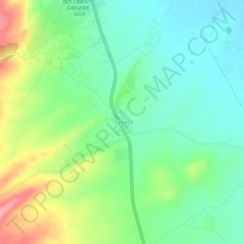
Name: Taxas topographic map, elevation, terrain.
Location: Taxas, Sigus, Sigus District, Oum El Bouaghi, Algeria (36.04704 6.79573 36.08704 6.83573)
Average elevation: 2,736 ft
Minimum elevation: 2,589 ft
Maximum elevation: 3,031 ft
Thank you for supporting this site ❤️
Make a donation
Make a donation
Gear up for your next adventure:
As an Amazon Associate, this site earns from qualifying purchases at no extra cost to you.