Geolocate

Pirk topographic map

Click on the map to display elevation.

Pirk

Sonstige Wohnplätze: Am Sonnenbühl | Haidthöhe

Wikipedia (CC-BY-SA 3.0)

About this map

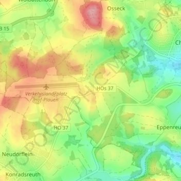
Name: Pirk topographic map, elevation, terrain.

Location: Pirk, Hof, Bayern, 95176, Deutschland (50.26745 11.84908 50.30745 11.88908)

Average elevation: 1,837 ft

Minimum elevation: 1,654 ft

Maximum elevation: 2,057 ft

Other topographic maps

Click on a map to view its topography, its elevation and its terrain.

95030

Deutschland > Bayern > Hof

Average elevation: 1,722 ft

95028

Deutschland > Bayern > Hof

Average elevation: 1,686 ft

Saale

Deutschland > Bayern > Hof > Unterkotzau

Average elevation: 1,657 ft

Gear up for your next adventure:

🏫Relief Map Kits - Hands-on tools for teaching landforms and elevation
📶Vehicle Signal Boosters - Improve reception in rural areas while driving to trailheads
🦺Reflective Outdoor Gear - Safety gear for low‑light conditions
🛠️Outdoor Gear Repair Kit - Essential tools to fix gear on the trail
📌Outdoor GPS Map App - Apps and devices for digital topographic navigation

As an Amazon Associate, this site earns from qualifying purchases at no extra cost to you.