
Fredericksburg topographic map
Interactive map
Click on the map to display elevation.
About this map
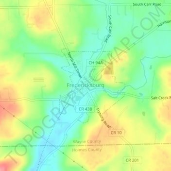
Name: Fredericksburg topographic map, elevation, terrain.
Location: Fredericksburg, Wayne County, Ohio, United States (40.67071 -81.87582 40.68247 -81.86219)
Average elevation: 1,063 ft
Minimum elevation: 942 ft
Maximum elevation: 1,227 ft