Geolocate

Challapata topographic map

Click on the map to display elevation.

About this map

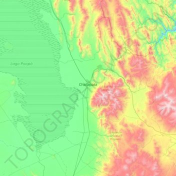
Name: Challapata topographic map, elevation, terrain.

Location: Challapata, Eduardo Abaroa, Oruro, Bolivia (-19.24696 -66.94185 -18.59015 -66.07758)

Average elevation: 13,018 ft

Minimum elevation: 11,516 ft

Maximum elevation: 16,759 ft

Gear up for your next adventure:

🥾Men's Hiking Boots - Durable, waterproof footwear for rugged terrain and steep inclines
🧤Tactile Hiking Gloves - Keep hands warm while operating GPS and smartphone screens
🏫Relief Map Kits - Hands-on tools for teaching landforms and elevation
🧦Hiking Socks - Comfortable socks to prevent blisters on long hikes
🎒Outdoor Daypacks - Lightweight backpacks designed for carrying maps and essential gear

As an Amazon Associate, this site earns from qualifying purchases at no extra cost to you.