
Moomba topographic map
Click on the map to display elevation.
About this map
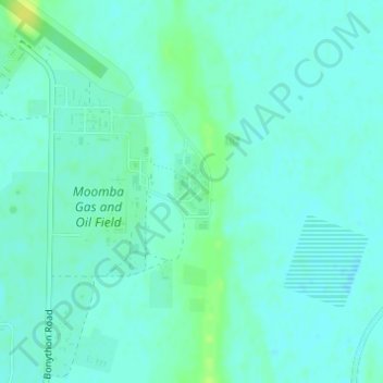
Name: Moomba topographic map, elevation, terrain.
Average elevation: 118 ft
Minimum elevation: 102 ft
Maximum elevation: 157 ft
Other topographic maps
Click on a map to view its topography, its elevation and its terrain.
Ikara-Flinders Ranges National Park
Australia > South Australia > Pastoral Unincorporated Area
Average elevation: 1,411 ft
Flinders Ranges
Australia > South Australia > Pastoral Unincorporated Area
Average elevation: 2,651 ft
Bunkers Conservation Reserve
Australia > South Australia > Pastoral Unincorporated Area
Average elevation: 1,621 ft
Dullingari
Australia > South Australia > Pastoral Unincorporated Area > Innamincka
Average elevation: 292 ft
Stokes Hill Lookout
Australia > South Australia > Pastoral Unincorporated Area
Average elevation: 2,244 ft
Wabma Kadarbu Mound Springs Conservation Park
Australia > South Australia > Pastoral Unincorporated Area
Average elevation: 59 ft
Nullabor Plain
Australia > South Australia > Pastoral Unincorporated Area
One theory is that the whole area was uplifted by crustal movements in the Miocene, and since then, erosion by wind and rain has reduced its thickness. The plain has most likely never had any major defining topographic features, resulting in the extremely flat terrain across the plain today.
Average elevation: 384 ft
Arkaroola Village
Australia > South Australia > Pastoral Unincorporated Area
Average elevation: 1,286 ft
Lyndhurst
Australia > South Australia > Pastoral Unincorporated Area > Lyndhurst
Average elevation: 436 ft
Carrapateena Hill
Australia > South Australia > Pastoral Unincorporated Area
Average elevation: 492 ft
Gum Creek Station
Australia > South Australia > Pastoral Unincorporated Area
Average elevation: 1,736 ft
Oodnadatta
Australia > South Australia > Pastoral Unincorporated Area
Oodnadatta is a small, remote outback town and locality in the Australian state of South Australia, located 1043 kilometres (648 miles) north-north-west of the state capital of Adelaide by road or 873 km (542 mi) direct, at an altitude of 112 metres (367 feet). The unsealed Oodnadatta Track, an outback road…
Average elevation: 427 ft
Malkumba-Coongie Lakes National Park
Australia > South Australia > Pastoral Unincorporated Area > Innamincka
Average elevation: 118 ft
Lake Acraman
Australia > South Australia > Pastoral Unincorporated Area
Oblique Landsat image of Lake Acraman draped over digital elevation model (10x vertical exaggeration), looking east towards the Flinders Ranges where ejecta has been found; screen capture from NASA World Wind.
Average elevation: 482 ft
Far West Coast Marine Park
Australia > South Australia > Pastoral Unincorporated Area
Average elevation: 217 ft
Mungerannie
Australia > South Australia > Pastoral Unincorporated Area > Mungerannie
Average elevation: 194 ft
Leigh Creek
Australia > South Australia > Pastoral Unincorporated Area > Leigh Creek
Average elevation: 876 ft
Fowlers Bay
Australia > South Australia > Pastoral Unincorporated Area > Fowlers Bay
Average elevation: 10 ft
Ironstone Hill Conservation Park
Australia > South Australia > Pastoral Unincorporated Area
Average elevation: 643 ft
Flinders Ranges
Australia > South Australia > Pastoral Unincorporated Area
Average elevation: 2,651 ft
Nilpena Ediacara National Park
Australia > South Australia > Pastoral Unincorporated Area
Average elevation: 276 ft