Mashobra topographic map
Interactive map
Click on the map to display elevation.
About this map
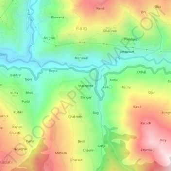
Name: Mashobra topographic map, elevation, terrain.
Location: Mashobra, Kotkhai, Shimla, Himachal Pradesh, 171202, India (31.09328 77.49335 31.13328 77.53335)
Average elevation: 6,175 ft
Minimum elevation: 4,823 ft
Maximum elevation: 8,051 ft
Other topographic maps
Click on a map to view its topography, its elevation and its terrain.
Purag
India > Himachal Pradesh > Kotkhai
Purag, Kotkhai, Shimla District, Himachal Pradesh, 171202, India
Average elevation: 6,119 ft
Bakhol
India > Himachal Pradesh > Kotkhai > Kadahi
Bakhol, Kadahi, Kotkhai, Shimla District, Himachal Pradesh, 171202, India
Average elevation: 6,375 ft