
Paquier topographic map
Click on the map to display elevation.
About this map
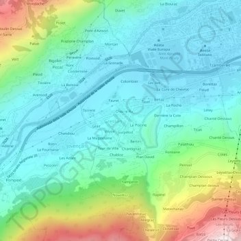
Name: Paquier topographic map, elevation, terrain.
Location: Paquier, Gressan, Aosta Valley, 11100, Italy (45.69923 7.26689 45.73923 7.30689)
Average elevation: 2,628 ft
Minimum elevation: 1,850 ft
Maximum elevation: 4,944 ft