Geolocate

Shire topographic map

Click on the map to display elevation.

About this map

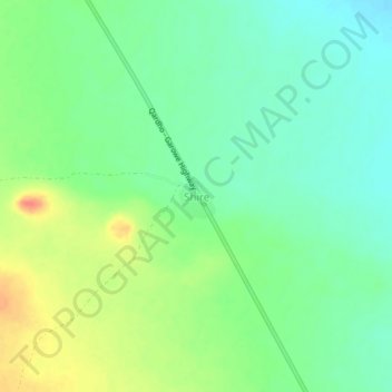
Name: Shire topographic map, elevation, terrain.

Location: Shire, Qardho District, Bari, Puntland, Somalia (9.07009 49.19289 9.11009 49.23289)

Average elevation: 2,280 ft

Minimum elevation: 2,215 ft

Maximum elevation: 2,388 ft

Gear up for your next adventure:

🥾Men's Hiking Boots - Durable, waterproof footwear for rugged terrain and steep inclines
🧭Orienteering Set - Complete compass and map reading kit
📖Nature Tracking Books - Learn to track wildlife and terrain
🧭Outdoor Navigation Book - Learn advanced navigation skills
🧣Merino Neck Gaiters - Multi-functional headwear for wind and sun protection

As an Amazon Associate, this site earns from qualifying purchases at no extra cost to you.