
Thank you for supporting this site ❤️
Make a donation
Make a donation
Gear up for your next adventure:
As an Amazon Associate, this site earns from qualifying purchases at no extra cost to you.
Vissoie topographic map
Click on the map to display elevation.
Thank you for supporting this site ❤️
Make a donation
Make a donation
Gear up for your next adventure:
As an Amazon Associate, this site earns from qualifying purchases at no extra cost to you.
About this map
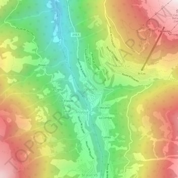
Name: Vissoie topographic map, elevation, terrain.
Location: Vissoie, Anniviers, Sierre, Wallis, 3961, Switzerland (46.19532 7.56536 46.23532 7.60536)
Average elevation: 5,246 ft
Minimum elevation: 2,923 ft
Maximum elevation: 8,009 ft
Thank you for supporting this site ❤️
Make a donation
Make a donation
Gear up for your next adventure:
As an Amazon Associate, this site earns from qualifying purchases at no extra cost to you.