
Thank you for supporting this site ❤️
Make a donation
Make a donation
Gear up for your next adventure:
As an Amazon Associate, this site earns from qualifying purchases at no extra cost to you.
Chun’an topographic map
Click on the map to display elevation.
Thank you for supporting this site ❤️
Make a donation
Make a donation
Gear up for your next adventure:
As an Amazon Associate, this site earns from qualifying purchases at no extra cost to you.
About this map
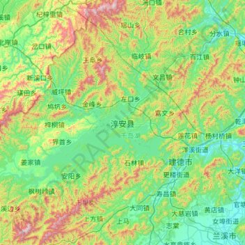
Name: Chun’an topographic map, elevation, terrain.
Location: Chun’an, Hangzhou, Zhejiang, China (29.18883 118.33969 30.03705 119.34344)
Average elevation: 1,083 ft
Minimum elevation: 49 ft
Maximum elevation: 4,806 ft
Thank you for supporting this site ❤️
Make a donation
Make a donation
Gear up for your next adventure:
As an Amazon Associate, this site earns from qualifying purchases at no extra cost to you.