
Thank you for supporting this site ❤️
Make a donation
Make a donation
Gear up for your next adventure:
As an Amazon Associate, this site earns from qualifying purchases at no extra cost to you.
Frassinere topographic map
Click on the map to display elevation.
Thank you for supporting this site ❤️
Make a donation
Make a donation
Gear up for your next adventure:
As an Amazon Associate, this site earns from qualifying purchases at no extra cost to you.
About this map
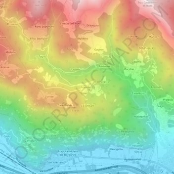
Name: Frassinere topographic map, elevation, terrain.
Location: Frassinere, Condoue, Turin, Piémont, 10055, Italie (45.11241 7.25780 45.15241 7.29780)
Average elevation: 2,861 ft
Minimum elevation: 1,227 ft
Maximum elevation: 5,039 ft
Thank you for supporting this site ❤️
Make a donation
Make a donation
Gear up for your next adventure:
As an Amazon Associate, this site earns from qualifying purchases at no extra cost to you.