
Thank you for supporting this site ❤️
Make a donation
Make a donation
Gear up for your next adventure:
As an Amazon Associate, this site earns from qualifying purchases at no extra cost to you.
Xoxoka topographic map
Click on the map to display elevation.
Thank you for supporting this site ❤️
Make a donation
Make a donation
Gear up for your next adventure:
As an Amazon Associate, this site earns from qualifying purchases at no extra cost to you.
About this map
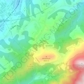
Name: Xoxoka topographic map, elevation, terrain.
Location: Xoxoka, Urnieta, Guipúzcoa, País Vasco, 20130, España (43.21633 -1.99314 43.23633 -1.97314)
Average elevation: 696 ft
Minimum elevation: 194 ft
Maximum elevation: 1,775 ft
Thank you for supporting this site ❤️
Make a donation
Make a donation
Gear up for your next adventure:
As an Amazon Associate, this site earns from qualifying purchases at no extra cost to you.