
Thank you for supporting this site ❤️
Make a donation
Make a donation
Gear up for your next adventure:
As an Amazon Associate, this site earns from qualifying purchases at no extra cost to you.
Bagno topographic map
Click on the map to display elevation.
Thank you for supporting this site ❤️
Make a donation
Make a donation
Gear up for your next adventure:
As an Amazon Associate, this site earns from qualifying purchases at no extra cost to you.
About this map
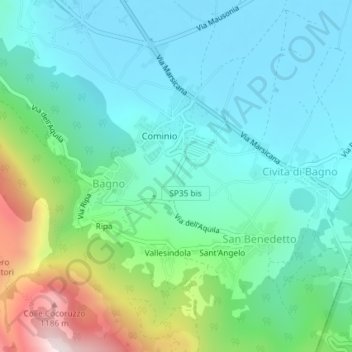
Name: Bagno topographic map, elevation, terrain.
Location: Bagno, Civita di Bagno, L'Aquila, Abruzzo, Italy (42.30049 13.41787 42.31684 13.44962)
Average elevation: 2,441 ft
Minimum elevation: 1,923 ft
Maximum elevation: 4,094 ft
Thank you for supporting this site ❤️
Make a donation
Make a donation
Gear up for your next adventure:
As an Amazon Associate, this site earns from qualifying purchases at no extra cost to you.