
Thank you for supporting this site ❤️
Make a donation
Make a donation
Gear up for your next adventure:
As an Amazon Associate, this site earns from qualifying purchases at no extra cost to you.
Hainhofen topographic map
Click on the map to display elevation.
Thank you for supporting this site ❤️
Make a donation
Make a donation
Gear up for your next adventure:
As an Amazon Associate, this site earns from qualifying purchases at no extra cost to you.
About this map
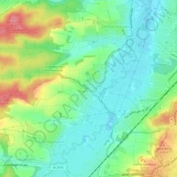
Name: Hainhofen topographic map, elevation, terrain.
Location: Hainhofen, Neusäß, Landkreis Augsburg, Bayern, Deutschland (48.37914 10.75748 48.39486 10.80822)
Average elevation: 1,594 ft
Minimum elevation: 1,490 ft
Maximum elevation: 1,785 ft
Thank you for supporting this site ❤️
Make a donation
Make a donation
Gear up for your next adventure:
As an Amazon Associate, this site earns from qualifying purchases at no extra cost to you.