Geolocate

Thistleton topographic map

Interactive map

Click on the map to display elevation.

About this map

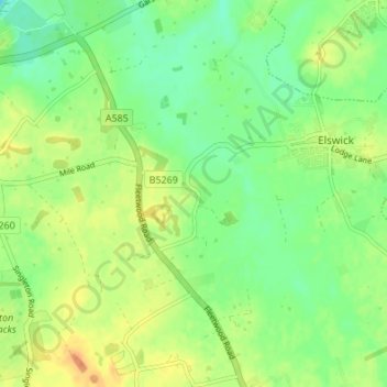
Name: Thistleton topographic map, elevation, terrain.

Location: Thistleton, Greenhalgh-with-Thistleton, Borough of Fylde, Lancashire, England, PR4 3XA, United Kingdom (53.81361 -2.92338 53.85361 -2.88338)

Average elevation: 56 ft

Minimum elevation: 0 ft

Maximum elevation: 125 ft

Other topographic maps

Click on a map to view its topography, its elevation and its terrain.

Lytham St Annes

United Kingdom > England > Lancashire > Borough of Fylde

Lytham St Annes, Borough of Fylde, Lancashire, England, FY8 4AR, United Kingdom

Average elevation: 16 ft

Warton Bank

United Kingdom > England > Lancashire > Borough of Fylde > Warton

Warton Bank, Bryning-with-Warton, Warton, Borough of Fylde, Lancashire, England, PR4 1TB, United Kingdom

Average elevation: 26 ft

Freckleton

United Kingdom > England > Lancashire > Borough of Fylde

Freckleton, Borough of Fylde, Lancashire, England, United Kingdom

Average elevation: 39 ft

Weeton

United Kingdom > England > Lancashire > Borough of Fylde

Weeton, Borough of Fylde, Lancashire, England, PR4 3PB, United Kingdom

Average elevation: 72 ft

Kirkham

United Kingdom > England > Lancashire > Borough of Fylde

Kirkham, Borough of Fylde, Lancashire, England, United Kingdom

Average elevation: 72 ft

Staining

United Kingdom > England > Lancashire > Borough of Fylde

Staining, Borough of Fylde, Lancashire, England, FY3 0BS, United Kingdom

Average elevation: 46 ft