
Thank you for supporting this site ❤️
Make a donation
Make a donation
Gear up for your next adventure:
As an Amazon Associate, this site earns from qualifying purchases at no extra cost to you.
Clovis topographic map
Click on the map to display elevation.
Thank you for supporting this site ❤️
Make a donation
Make a donation
Gear up for your next adventure:
As an Amazon Associate, this site earns from qualifying purchases at no extra cost to you.
About this map
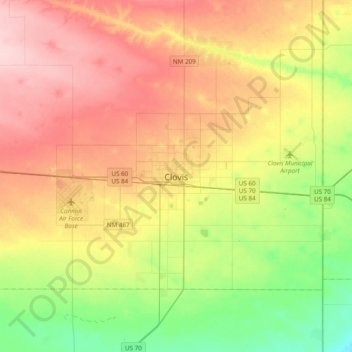
Name: Clovis topographic map, elevation, terrain.
Location: Clovis, Curry County, New Mexico, 88101, United States (34.24547 -103.36507 34.56547 -103.04507)
Average elevation: 4,249 ft
Minimum elevation: 3,993 ft
Maximum elevation: 4,534 ft
Curry County trails, hiking, mountain biking, running and outdoor activities
Thank you for supporting this site ❤️
Make a donation
Make a donation
Gear up for your next adventure:
As an Amazon Associate, this site earns from qualifying purchases at no extra cost to you.