Geolocate

Doffing topographic map

Click on the map to display elevation.

About this map

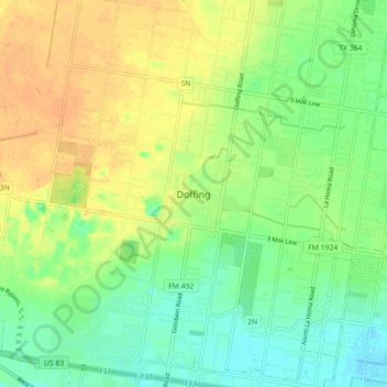
Name: Doffing topographic map, elevation, terrain.

Location: Doffing, Hidalgo County, Texas, 78560, United States (26.23452 -98.42585 26.31452 -98.34585)

Average elevation: 187 ft

Minimum elevation: 138 ft

Maximum elevation: 240 ft

Hidalgo County trails, hiking, mountain biking, running and outdoor activities

Gear up for your next adventure:

📌Outdoor GPS Map App - Apps and devices for digital topographic navigation
🎒Waterproof Dry Bags - Keep your electronics and maps dry inside your pack
🕶️GPS Smartphone Mount - Secure mount for phone navigation
🩹Survival Bandages - High‑quality bandages for emergencies
🔋Solar Power Banks - Keep your GPS and phone charged in remote wilderness areas

As an Amazon Associate, this site earns from qualifying purchases at no extra cost to you.