
Make a donation
Gear up for your next adventure:
As an Amazon Associate, this site earns from qualifying purchases at no extra cost to you.
Tláhuac topographic map
Click on the map to display elevation.
Make a donation
Gear up for your next adventure:
As an Amazon Associate, this site earns from qualifying purchases at no extra cost to you.
Tláhuac
The borough of Tláhuac is located in the southeastern part of the Mexico City, about 60 km from the historic center of Mexico City . It is bordered by the boroughs of Iztapalapa, Milpa Alta and Xochimilco as well as the municipality of Valle de Chalco Solidaridad in the State of Mexico . The borough extends over 89.5.km2 of territory, accounting for 5.75% of the Mexico City. The borough is part of the Valley of Mexico, in the Trans-Mexican Volcanic Belt that extends across central Mexico. The borough expands over much of the former Lake Chalco and Lake Xochimilco where the two connected, which were drained over the centuries since the Spanish conquest. The territory is classified into three zones, flat lakebed, transitional areas and hills with accumulated volcanic materials. The main elevations include the Guadalupe Volcano, the Xaltepec Volcano, Tecuautzi, Tetecón, the Sierra de Santa Catarina and Teuhtli Volcano. The Sierra de Santa Catarina is a small volcanic belt which has elevations of up to 2,800 meters above sea level. It serves as an important aquifer recharge area as well as a barrier to urban sprawl from Iztapalapa on the other side. On the south end is the Tehuitli Volcanco with an altitude of 2,700 meters above sea level.
Make a donation
Gear up for your next adventure:
As an Amazon Associate, this site earns from qualifying purchases at no extra cost to you.
About this map
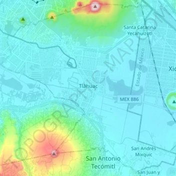
Name: Tláhuac topographic map, elevation, terrain.
Location: Tláhuac, Mexico City, Mexico (19.21057 -99.06897 19.32713 -98.94030)
Average elevation: 7,507 ft
Minimum elevation: 7,293 ft
Maximum elevation: 8,990 ft
Make a donation
Gear up for your next adventure:
As an Amazon Associate, this site earns from qualifying purchases at no extra cost to you.
Other topographic maps
Click on a map to view its topography, its elevation and its terrain.
Xochimilco
Much of the borough's land is former lakebed. Its main elevations include Xochitepec and Tlacualleli mountains along with two volcanoes named Teutli and Tzompol. It contains two natural rivers called Santiago and Tepapantla along with the various canals, which is what is left of the lake. The elevated areas of…
Average elevation: 7,352 ft
Make a donation
Gear up for your next adventure:
As an Amazon Associate, this site earns from qualifying purchases at no extra cost to you.