Geolocate

Vargo topographic map

Click on the map to display elevation.

About this map

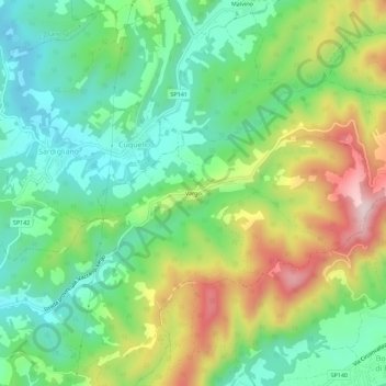
Name: Vargo topographic map, elevation, terrain.

Location: Vargo, Stazzano, Alessandria, Piemonte, 15060, Italia (44.72852 8.89599 44.76852 8.93599)

Average elevation: 1,115 ft

Minimum elevation: 669 ft

Maximum elevation: 1,906 ft

Gear up for your next adventure:

🧦Merino Wool Socks - Moisture-wicking, blister-preventing socks for long treks
🔦Powerful Headlamps - Ultra-bright hands-free lighting for night navigation
🧴Hand Sanitizer - Keep hands clean while hiking
🪑Portable Camp Table - Compact table for campsite meals
🧭Hiking Compass - Precision compass for reliable navigation in the wilderness

As an Amazon Associate, this site earns from qualifying purchases at no extra cost to you.