
Thank you for supporting this site ❤️
Make a donation
Make a donation
Gear up for your next adventure:
As an Amazon Associate, this site earns from qualifying purchases at no extra cost to you.
Königsee topographic map
Click on the map to display elevation.
Thank you for supporting this site ❤️
Make a donation
Make a donation
Gear up for your next adventure:
As an Amazon Associate, this site earns from qualifying purchases at no extra cost to you.
About this map
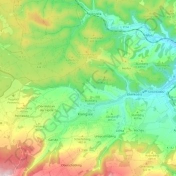
Name: Königsee topographic map, elevation, terrain.
Location: Königsee, Landkreis Saalfeld-Rudolstadt, Thuringia, Germany (50.65097 11.00894 50.69309 11.12160)
Average elevation: 1,424 ft
Minimum elevation: 951 ft
Maximum elevation: 2,208 ft
Thank you for supporting this site ❤️
Make a donation
Make a donation
Gear up for your next adventure:
As an Amazon Associate, this site earns from qualifying purchases at no extra cost to you.