
Thank you for supporting this site ❤️
Make a donation
Make a donation
Gear up for your next adventure:
As an Amazon Associate, this site earns from qualifying purchases at no extra cost to you.
Runyinya topographic map
Click on the map to display elevation.
Thank you for supporting this site ❤️
Make a donation
Make a donation
Gear up for your next adventure:
As an Amazon Associate, this site earns from qualifying purchases at no extra cost to you.
About this map
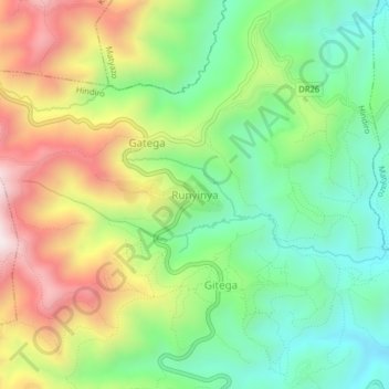
Name: Runyinya topographic map, elevation, terrain.
Location: Runyinya, Hindiro, Ngororero, Western Province, Rwanda (-1.80865 29.58557 -1.76865 29.62557)
Average elevation: 6,339 ft
Minimum elevation: 5,338 ft
Maximum elevation: 7,841 ft
Thank you for supporting this site ❤️
Make a donation
Make a donation
Gear up for your next adventure:
As an Amazon Associate, this site earns from qualifying purchases at no extra cost to you.