Geolocate

Southside Place topographic map

Click on the map to display elevation.

About this map

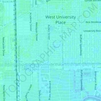
Name: Southside Place topographic map, elevation, terrain.

Location: Southside Place, Harris County, Texas, United States (29.70458 -95.44572 29.71489 -95.43312)

Average elevation: 62 ft

Minimum elevation: 56 ft

Maximum elevation: 66 ft

Harris County trails, hiking, mountain biking, running and outdoor activities

Gear up for your next adventure:

🥾Men's Hiking Boots - Durable, waterproof footwear for rugged terrain and steep inclines
🧼Biodegradable Camping Soap - Eco‑friendly soap for outdoor hygiene
🧯Emergency Survival Kit - All‑in‑one survival essentials for the backcountry
🔥Plasma Lighters - Windproof lighters that work in any weather condition
🧣Merino Neck Gaiters - Multi-functional headwear for wind and sun protection

As an Amazon Associate, this site earns from qualifying purchases at no extra cost to you.