
Thank you for supporting this site ❤️
Make a donation
Make a donation
Gear up for your next adventure:
As an Amazon Associate, this site earns from qualifying purchases at no extra cost to you.
Pakrac topographic map
Click on the map to display elevation.
Thank you for supporting this site ❤️
Make a donation
Make a donation
Gear up for your next adventure:
As an Amazon Associate, this site earns from qualifying purchases at no extra cost to you.
About this map
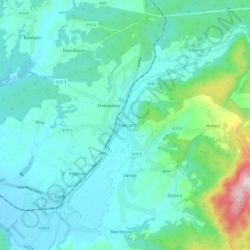
Name: Pakrac topographic map, elevation, terrain.
Location: Pakrac, Grad Pakrac, Požega-Slavonia County, 34550, Croatia (45.39623 17.15293 45.47623 17.23293)
Average elevation: 745 ft
Minimum elevation: 453 ft
Maximum elevation: 2,142 ft
Thank you for supporting this site ❤️
Make a donation
Make a donation
Gear up for your next adventure:
As an Amazon Associate, this site earns from qualifying purchases at no extra cost to you.