
Thank you for supporting this site ❤️
Make a donation
Make a donation
Gear up for your next adventure:
As an Amazon Associate, this site earns from qualifying purchases at no extra cost to you.
Carpaneto topographic map
Click on the map to display elevation.
Thank you for supporting this site ❤️
Make a donation
Make a donation
Gear up for your next adventure:
As an Amazon Associate, this site earns from qualifying purchases at no extra cost to you.
About this map
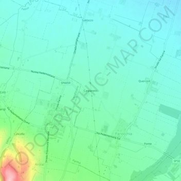
Name: Carpaneto topographic map, elevation, terrain.
Location: Carpaneto, Vigatto, Panocchia, Parma, Emilia-Romagna, Italia (44.66829 10.28010 44.70829 10.32010)
Average elevation: 538 ft
Minimum elevation: 423 ft
Maximum elevation: 971 ft
Thank you for supporting this site ❤️
Make a donation
Make a donation
Gear up for your next adventure:
As an Amazon Associate, this site earns from qualifying purchases at no extra cost to you.