
Thank you for supporting this site ❤️
Make a donation
Make a donation
Gear up for your next adventure:
As an Amazon Associate, this site earns from qualifying purchases at no extra cost to you.
东拉乡 topographic map
Click on the map to display elevation.
Thank you for supporting this site ❤️
Make a donation
Make a donation
Gear up for your next adventure:
As an Amazon Associate, this site earns from qualifying purchases at no extra cost to you.
About this map
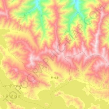
Name: 东拉乡 topographic map, elevation, terrain.
Location: 东拉乡, 贡嘎县, 山南市, Tibet, China (28.93898 90.61473 29.20357 90.91225)
Average elevation: 15,108 ft
Minimum elevation: 12,205 ft
Maximum elevation: 17,831 ft
Thank you for supporting this site ❤️
Make a donation
Make a donation
Gear up for your next adventure:
As an Amazon Associate, this site earns from qualifying purchases at no extra cost to you.