
La Guardia topographic map
Click on the map to display elevation.
About this map
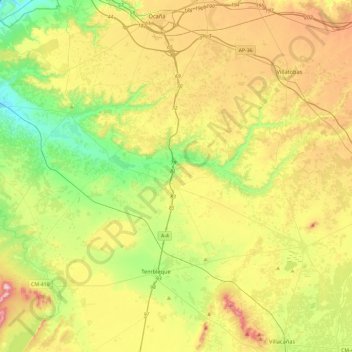
Name: La Guardia topographic map, elevation, terrain.
Location: La Guardia, Mesa de Ocaña, Toledo, Castile-La Mancha, Spain (39.72369 -3.81812 39.86521 -3.34889)
Average elevation: 2,254 ft
Minimum elevation: 1,686 ft
Maximum elevation: 3,104 ft