Geolocate

Ogod topographic map

Click on the map to display elevation.

About this map

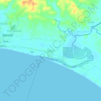
Name: Ogod topographic map, elevation, terrain.

Location: Ogod, Donsol, Sorsogon, Bicol Region, 4715, Philippines (12.88161 123.59603 12.92161 123.63603)

Average elevation: 20 ft

Minimum elevation: -7 ft

Maximum elevation: 118 ft

Gear up for your next adventure:

🪶Wildlife Field Guides - Learn animal tracking and species ID
🧯Portable Fire Pit - Compact fire pit for camping spots
🔥Fast-Boil Camping Stoves - Efficient cooking systems for quick trail meals
🔭Telescopic Hiking Pole - Adjustable pole for hiking stability
🧢Sun Protection Hats - Wide-brimmed and UPF-rated hats for high-altitude sun safety

As an Amazon Associate, this site earns from qualifying purchases at no extra cost to you.