
Amery topographic map
Click on the map to display elevation.
About this map
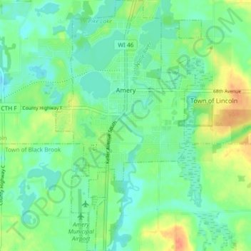
Name: Amery topographic map, elevation, terrain.
Location: Amery, Polk County, Wisconsin, United States (45.27395 -92.38261 45.32530 -92.34016)
Average elevation: 1,083 ft
Minimum elevation: 1,037 ft
Maximum elevation: 1,175 ft
Polk County trails, hiking, mountain biking, running and outdoor activities
Other topographic maps
Click on a map to view its topography, its elevation and its terrain.