
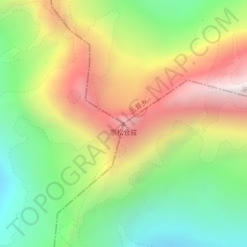
宗松仓拉 topographic map
Interactive map
Click on the map to display elevation.
About this map
Name: 宗松仓拉 topographic map, elevation, terrain.
Location: 宗松仓拉, 格当乡, 墨脱县, 林芝市, 西藏自治区, 中国 (29.54376 96.08638 29.54386 96.08648)
Average elevation: 16,325 ft
Minimum elevation: 14,308 ft
Maximum elevation: 18,875 ft
Other topographic maps
Click on a map to view its topography, its elevation and its terrain.