
Åsgardfonna topographic map
Interactive map
Click on the map to display elevation.
About this map
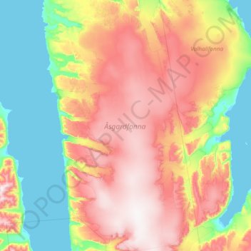
Name: Åsgardfonna topographic map, elevation, terrain.
Location: Åsgardfonna, Spitzbergen, Norwegen (79.31307 15.77969 79.82871 17.33407)
Average elevation: 1,322 ft
Minimum elevation: -3 ft
Maximum elevation: 3,822 ft
Other topographic maps
Click on a map to view its topography, its elevation and its terrain.