
Storfjorden topographic map
Interactive map
Click on the map to display elevation.
About this map
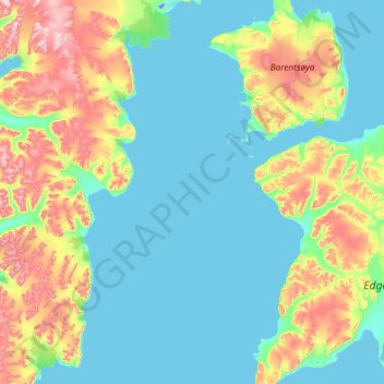
Name: Storfjorden topographic map, elevation, terrain.
Location: Storfjorden, Spitzbergen, Norwegen (77.44671 18.24015 78.61634 21.54535)
Average elevation: 515 ft
Minimum elevation: -46 ft
Maximum elevation: 3,632 ft
Other topographic maps
Click on a map to view its topography, its elevation and its terrain.