Geolocate

Mount Liberty topographic map

Click on the map to display elevation.

About this map

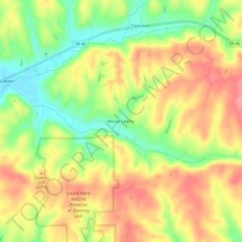
Name: Mount Liberty topographic map, elevation, terrain.

Location: Mount Liberty, Brown County, Indiana, United States (39.16422 -86.15027 39.20422 -86.11027)

Average elevation: 791 ft

Minimum elevation: 630 ft

Maximum elevation: 928 ft

Brown County trails, hiking, mountain biking, running and outdoor activities

Gear up for your next adventure:

📶Satellite Messenger - Communication device off‑grid
🔦LED Headlamp - Bright and durable LED headlamp for night navigation
🎒Outdoor Daypacks - Lightweight backpacks designed for carrying maps and essential gear
🔦Compact Flashlight - Reliable flashlight for emergencies
🔥Plasma Lighters - Windproof lighters that work in any weather condition

As an Amazon Associate, this site earns from qualifying purchases at no extra cost to you.