Geolocate

Adams topographic map

Click on the map to display elevation.

About this map

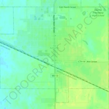
Name: Adams topographic map, elevation, terrain.

Location: Adams, Adams County, Wisconsin, United States (43.94138 -89.83784 43.96685 -89.79750)

Average elevation: 968 ft

Minimum elevation: 942 ft

Maximum elevation: 994 ft

Adams County trails, hiking, mountain biking, running and outdoor activities

Other topographic maps

Click on a map to view its topography, its elevation and its terrain.

Lake Camelot

United States > Wisconsin > Adams County

Average elevation: 1,024 ft

Lake Sherwood

United States > Wisconsin > Adams County

Average elevation: 1,010 ft

Easton

United States > Wisconsin > Adams County

Average elevation: 942 ft

Arkdale

United States > Wisconsin > Adams County

Average elevation: 942 ft

Grand Marsh

United States > Wisconsin > Adams County

Average elevation: 1,010 ft

White Creek

United States > Wisconsin > Adams County

Average elevation: 899 ft

Lake Arrowhead

United States > Wisconsin > Adams County

Average elevation: 991 ft

Dellwood

United States > Wisconsin > Adams County

Average elevation: 912 ft

Gear up for your next adventure:

🌡️Handheld Weather Meters - Measure wind, temp, and pressure for safe mountain travel
📖Nature Tracking Books - Learn to track wildlife and terrain
🧤Hiking Gloves - Protective gloves for rugged trails
🪶Camping Sleeping Pad - Comfortable sleeping pad for backpacking
🛠️Backpacking Tool Kit - Essential toolkit for outdoor repairs

As an Amazon Associate, this site earns from qualifying purchases at no extra cost to you.