
Make a donation
Gear up for your next adventure:
As an Amazon Associate, this site earns from qualifying purchases at no extra cost to you.
Prora topographic map
Click on the map to display elevation.
Make a donation
Gear up for your next adventure:
As an Amazon Associate, this site earns from qualifying purchases at no extra cost to you.
Prora
Damals fanden die Bauarbeiten internationale Beachtung. So wurde bei der Weltausstellung 1937 in Paris ein Modell des Seebades Prora mit einem Grand Prix ausgezeichnet. Zu diesem Zeitpunkt zeichnete sich ab, dass die von DAF-Chef Robert Ley vorgegebene Kostengrenze in Höhe von 50 Millionen Reichsmark (40 Mio. Mark Baukosten und 10 Mio. Mark Ausstattung) deutlich überschritten werden würde. Eine von der KdF-Bauleitung 1938 erstellte „Kostenzusammenstellung zum Neubau des KdF-Seebades Rügen“ bezifferte die Baukosten auf 237,5 Millionen Mark (kaufkraftbereinigt in heutiger Währung: rund 1.164 Millionen Euro).
Make a donation
Gear up for your next adventure:
As an Amazon Associate, this site earns from qualifying purchases at no extra cost to you.
About this map
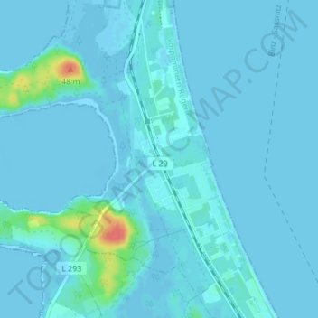
Name: Prora topographic map, elevation, terrain.
Average elevation: 10 ft
Minimum elevation: -16 ft
Maximum elevation: 180 ft
Make a donation
Gear up for your next adventure:
As an Amazon Associate, this site earns from qualifying purchases at no extra cost to you.