
Thank you for supporting this site ❤️
Make a donation
Make a donation
Gear up for your next adventure:
As an Amazon Associate, this site earns from qualifying purchases at no extra cost to you.
Lagunillas topographic map
Click on the map to display elevation.
Thank you for supporting this site ❤️
Make a donation
Make a donation
Gear up for your next adventure:
As an Amazon Associate, this site earns from qualifying purchases at no extra cost to you.
About this map
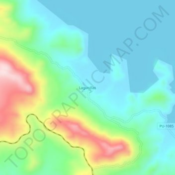
Name: Lagunillas topographic map, elevation, terrain.
Location: Lagunillas, Santa Lucía, Lampa, Puno, Perú (-15.76706 -70.78832 -15.72706 -70.74832)
Average elevation: 13,986 ft
Minimum elevation: 13,678 ft
Maximum elevation: 14,829 ft
Thank you for supporting this site ❤️
Make a donation
Make a donation
Gear up for your next adventure:
As an Amazon Associate, this site earns from qualifying purchases at no extra cost to you.