
Thank you for supporting this site ❤️
Make a donation
Make a donation
Gear up for your next adventure:
As an Amazon Associate, this site earns from qualifying purchases at no extra cost to you.
Viratnagar topographic map
Click on the map to display elevation.
Thank you for supporting this site ❤️
Make a donation
Make a donation
Gear up for your next adventure:
As an Amazon Associate, this site earns from qualifying purchases at no extra cost to you.
About this map
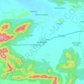
Name: Viratnagar topographic map, elevation, terrain.
Location: Viratnagar, Viratnagar Tehsil, 齋浦爾, 拉贾斯坦邦, 303102, 印度 (27.39449 76.14234 27.47449 76.22234)
Average elevation: 1,565 ft
Minimum elevation: 1,362 ft
Maximum elevation: 2,448 ft
Thank you for supporting this site ❤️
Make a donation
Make a donation
Gear up for your next adventure:
As an Amazon Associate, this site earns from qualifying purchases at no extra cost to you.