
Thank you for supporting this site ❤️
Make a donation
Make a donation
Gear up for your next adventure:
As an Amazon Associate, this site earns from qualifying purchases at no extra cost to you.
Mutuati topographic map
Click on the map to display elevation.
Thank you for supporting this site ❤️
Make a donation
Make a donation
Gear up for your next adventure:
As an Amazon Associate, this site earns from qualifying purchases at no extra cost to you.
About this map
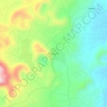
Name: Mutuati topographic map, elevation, terrain.
Location: Mutuati, Igembe North, Meru County, Eastern, Kenya (0.36173 37.95891 0.40173 37.99891)
Average elevation: 5,495 ft
Minimum elevation: 4,915 ft
Maximum elevation: 6,588 ft
Thank you for supporting this site ❤️
Make a donation
Make a donation
Gear up for your next adventure:
As an Amazon Associate, this site earns from qualifying purchases at no extra cost to you.