Geolocate

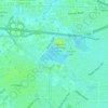
Burtons topographic map

Click on the map to display elevation.

About this map

Name: Burtons topographic map, elevation, terrain.

Location: Burtons, Virginia Beach, Virginia, 23502, United States (36.86543 -76.21577 36.90543 -76.17577)

Average elevation: 23 ft

Minimum elevation: -23 ft

Maximum elevation: 49 ft

Virginia trails, hiking, mountain biking, running and outdoor activities

Other topographic maps

Click on a map to view its topography, its elevation and its terrain.
Stumpy Lake

United States > Virginia > Virginia Beach > Glenwood

Average elevation: 23 ft

Gear up for your next adventure:

🥄Camping Utensil Set - Lightweight utensils for outdoor meals
🥩Freeze-Dried Meals - Nutritious and lightweight food for remote expeditions
🧷Carabiner Set - Durable clips for gear attachment
⛺Backpacking Tents - Weight-optimized shelters for multi-day topographic surveys
🪑Portable Camp Table - Compact table for campsite meals

As an Amazon Associate, this site earns from qualifying purchases at no extra cost to you.