Geolocate

March topographic map

Click on the map to display elevation.

About this map

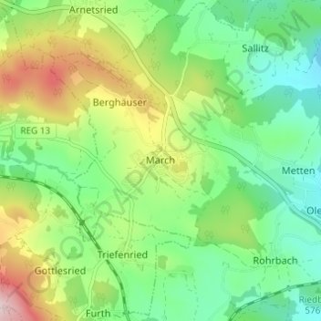
Name: March topographic map, elevation, terrain.

Location: March, Regen, Landkreis Regen, Bayern, Deutschland (48.95699 13.04806 48.99699 13.08806)

Average elevation: 2,057 ft

Minimum elevation: 1,670 ft

Maximum elevation: 2,789 ft

Gear up for your next adventure:

🦶Hiking Gaiters - Keep debris and water out of your boots
🚗GPS Dash Cams - Record your scenic drives through mountain passes and canyons
🗺️Topographic Maps - Detailed topo maps for hiking, exploring and outdoor navigation
🧭Outdoor Navigation Book - Learn advanced navigation skills
🧼Biodegradable Camping Soap - Eco‑friendly soap for outdoor hygiene

As an Amazon Associate, this site earns from qualifying purchases at no extra cost to you.