Geolocate

Sleepy Eye topographic map

Interactive map

Click on the map to display elevation.

About this map

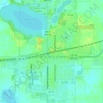
Name: Sleepy Eye topographic map, elevation, terrain.

Location: Sleepy Eye, Brown County, Minnesota, United States (44.28544 -94.74025 44.31186 -94.70536)

Average elevation: 1,017 ft

Minimum elevation: 994 ft

Maximum elevation: 1,050 ft

Other topographic maps

Click on a map to view its topography, its elevation and its terrain.

Hanska

United States > Minnesota > Brown County

Hanska, Brown County, Minnesota, United States

Average elevation: 1,010 ft

Springfield

United States > Minnesota > Brown County

Springfield, Brown County, Minnesota, United States

Average elevation: 1,053 ft

Evan

United States > Minnesota > Brown County

Evan, Brown County, Minnesota, United States

Average elevation: 1,027 ft

New Ulm

United States > Minnesota > Brown County

New Ulm, Brown County, Minnesota, 56073, United States

Average elevation: 912 ft

Cobden

United States > Minnesota > Brown County

Cobden, Brown County, Minnesota, United States

Average elevation: 1,027 ft

Comfrey

United States > Minnesota > Brown County

Comfrey, Brown County, Minnesota, United States

Average elevation: 1,129 ft