Geolocate

Storden topographic map

Interactive map

Click on the map to display elevation.

About this map

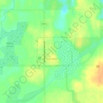
Name: Storden topographic map, elevation, terrain.

Location: Storden, Cottonwood County, Minnesota, United States (44.03588 -95.32368 44.04342 -95.31086)

Average elevation: 1,388 ft

Minimum elevation: 1,339 ft

Maximum elevation: 1,440 ft

Other topographic maps

Click on a map to view its topography, its elevation and its terrain.

Bingham Lake

United States > Minnesota > Cottonwood County

Bingham Lake, Cottonwood County, Minnesota, United States

Average elevation: 1,407 ft

Jeffers

United States > Minnesota > Cottonwood County

Jeffers, Cottonwood County, Minnesota, United States

Average elevation: 1,476 ft

Westbrook

United States > Minnesota > Cottonwood County

Westbrook, Cottonwood County, Minnesota, United States

Average elevation: 1,430 ft

Mountain Lake

United States > Minnesota > Cottonwood County

Mountain Lake, Cottonwood County, Minnesota, United States

Average elevation: 1,293 ft

Windom

United States > Minnesota > Cottonwood County

Windom, Cottonwood County, Minnesota, United States

Average elevation: 1,394 ft