Geolocate

Geisenried topographic map

Click on the map to display elevation.

About this map

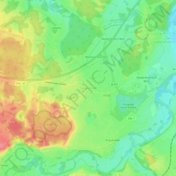
Name: Geisenried topographic map, elevation, terrain.

Location: Geisenried, Marktoberdorf, Landkreis Ostallgäu, Bayern, 87616, Deutschland (47.75048 10.54212 47.79048 10.58212)

Average elevation: 2,470 ft

Minimum elevation: 2,359 ft

Maximum elevation: 2,615 ft

Other topographic maps

Click on a map to view its topography, its elevation and its terrain.

Gear up for your next adventure:

🧭Hiking Compass - Precision compass for reliable navigation in the wilderness
🌐World Map Poster - Decorative world maps with topographic info
👟Men's Trail Runners - Lightweight footwear for fast-paced exploration and light hiking
🪑Portable Camp Table - Compact table for campsite meals
📷Action Camera - Capture your outdoor adventures in HD

As an Amazon Associate, this site earns from qualifying purchases at no extra cost to you.