Geolocate

Sarain topographic map

Click on the map to display elevation.

About this map

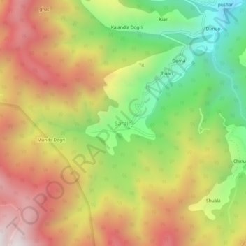
Name: Sarain topographic map, elevation, terrain.

Location: Sarain, Chaupal, Shimla, Himachal Pradesh, India (30.88309 77.49355 30.92309 77.53355)

Average elevation: 7,900 ft

Minimum elevation: 5,827 ft

Maximum elevation: 9,954 ft

Gear up for your next adventure:

🧭Orienteering Set - Complete compass and map reading kit
💧Water Filtration Bottles - Safely drink from streams and lakes while exploring
🛰️Satellite Messengers - Emergency SOS and two-way messaging for off-grid adventures
🏥Hiking First Aid Kits - Comprehensive medical kits for remote trail injuries
⛑️Personal Locator Beacon - Safety beacon for emergencies

As an Amazon Associate, this site earns from qualifying purchases at no extra cost to you.